
Footpath to Freeway: Michigan Road Maps
- Introduction
- Michigan as a Territory
- State of Michigan - 19th Century
- Automobile Route Guides
- Named Roads
- Standardization of Road Markings
- Rise and Fall of Oil Company Road Maps
- Beginning of a New Era
Footpath to Freeway: The Evolution of Michigan Road Maps
This exhibit traces how roads have been depicted on Michigan maps from the time it was a territory to the present. In addition to maps, it includes photographs, unique short-lived route guides and artifacts. Maps evolved in step with the road system and showed advances such as named roads which were in time replaced with numbered state and federal routes. Publishers include map giants Rand McNally and Gousha who also supplied oil companies with their ubiquitous freely distributed roadmaps.
Part 1: Michigan As A Territory
Click on thumbnail image to view larger image.
Map of the United States, exhibiting the post-roads, the situations, connexions & distances of the post-offices, stage roads, counties, & principal rivers, 3rd ed
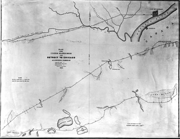
Plan of the United States road from Detroit to Chicago, as surveyed & marked by James McCloskey, Jonah Baldwin, Laureat Durocher; copied by John Farmer
In 1825, Federal funds were appropriated for a road linking the forts at Detroit and Chicago, and the route, following the winding and irregular path of the ancient Sauk (Indian) trail, was surveyed later that year. This strip (point-to-point) map of the surveyed route, known as the Chicago Road, was copied by Farmer in 1825 and is the first Michigan map to focus on one road.
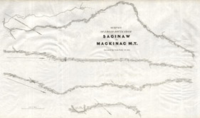
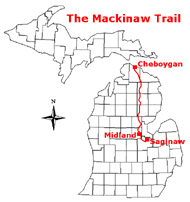
Survey of a road route from Saginaw to Mackinac
During this period, a military road was proposed to establish a link between Saginaw with Fort Mackinaw. In 1835, Lt. Poole was commissioned to survey this route, one that followed the Indian path known as the Mackinaw trail. The portrayed survey map, which accompanied his report, was also drawn in strip format. No road passable for vehicles was constructed on this or any other north-south route to northern Lower Michigan, however, until several decades later.
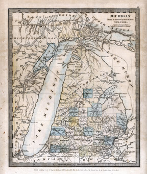
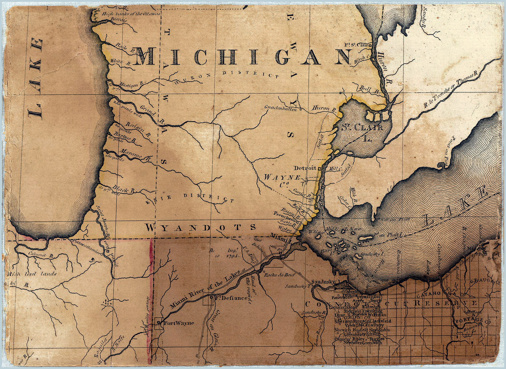
Michigan
Maps portraying the entire Michigan territory, such as this 1831 Burr map, eventually began to incorporate and reflect the major roads. The most prominent of the roads depicted was the Chicago road, which was "at this period one of the great thoroughfares of the country." (Quaife, 1923, p.42) One observer counted 250 wagons in a single day and by 1835 daily stages were running from Detroit to Chicago.
A network of roads extended across the southern two tiers of counties in Lower Michigan and expanded with settlement growth. "The system of early roads underscored the east–west dynamic of pioneer activity" (Dantzer, 2005 p.) and gave Michigan maps more of an east-west orientation rather than the north-south perspective.